Our Frac Modeling and Well Placement Optimization Services
Identify the Best Well Placement Opportunities
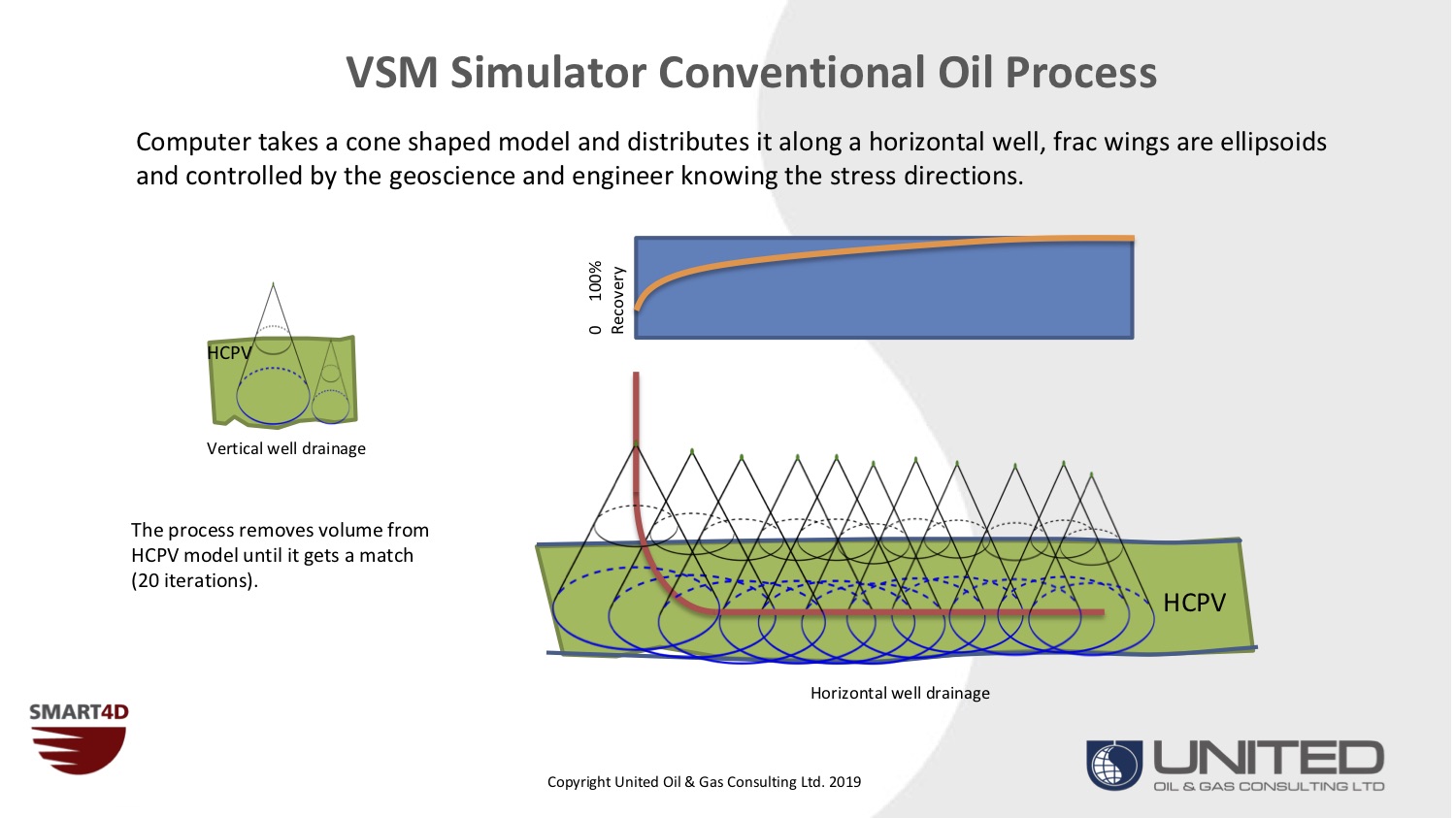
United can deliver analysis of remaining oil opportunities in Unconventional, Tight, and Shale Oil, in addition to conventional waterflood and heavy oil reservoirs. Volumetric Sweep Mapping (VSM) is unique combination of reservoir engineering tools integrated with detailed/high resolution 3D geological framework within SMART4D.
We identify footprint boundaries and enable you to exploit remaining hydrocarbon opportunities in mature and more complex fields
Our Case Study
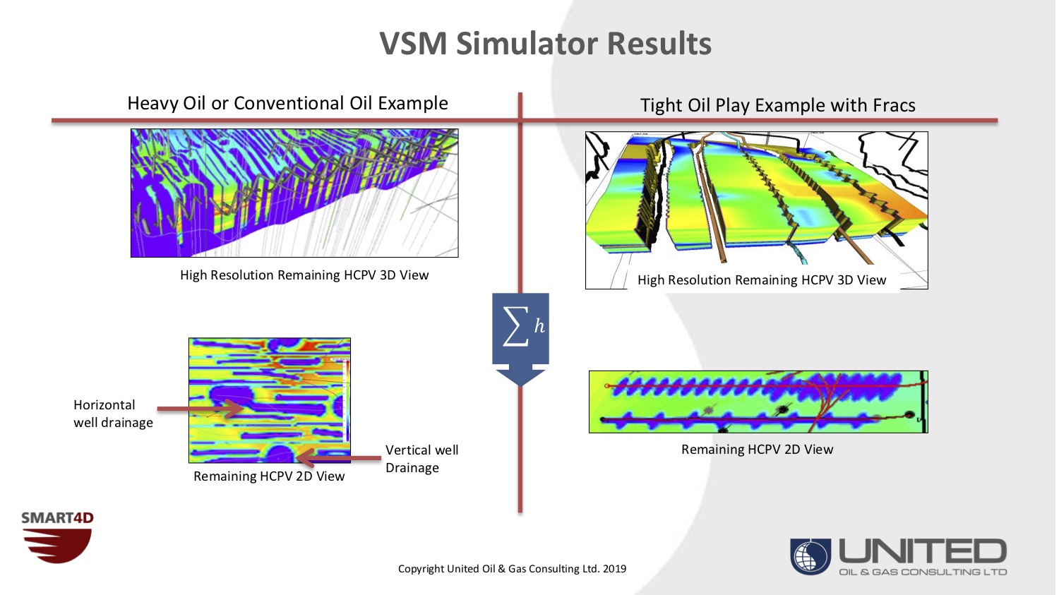
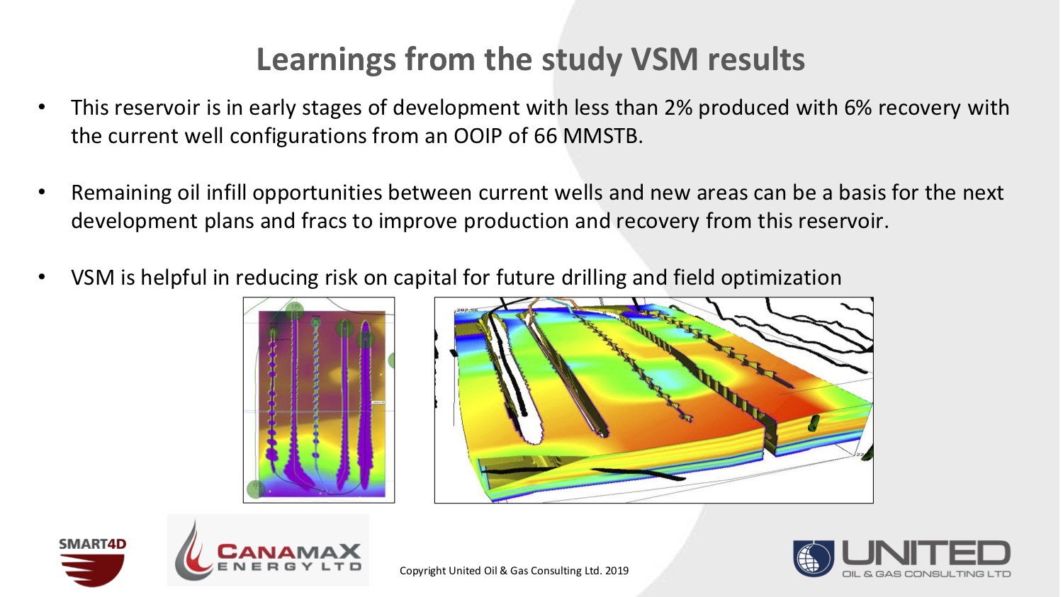
Our Clients have used VSM to identify remaining oil infill opportunities between current wells and new areas. These studies can be a basis for the next development plans and planning of fracs to improve production and recovery from their reservoir.
Optimize Well Footprints
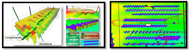
Our VSM services leverages our proprietary volumetric simulator VSM to
- Model drainage footprints of wellbores
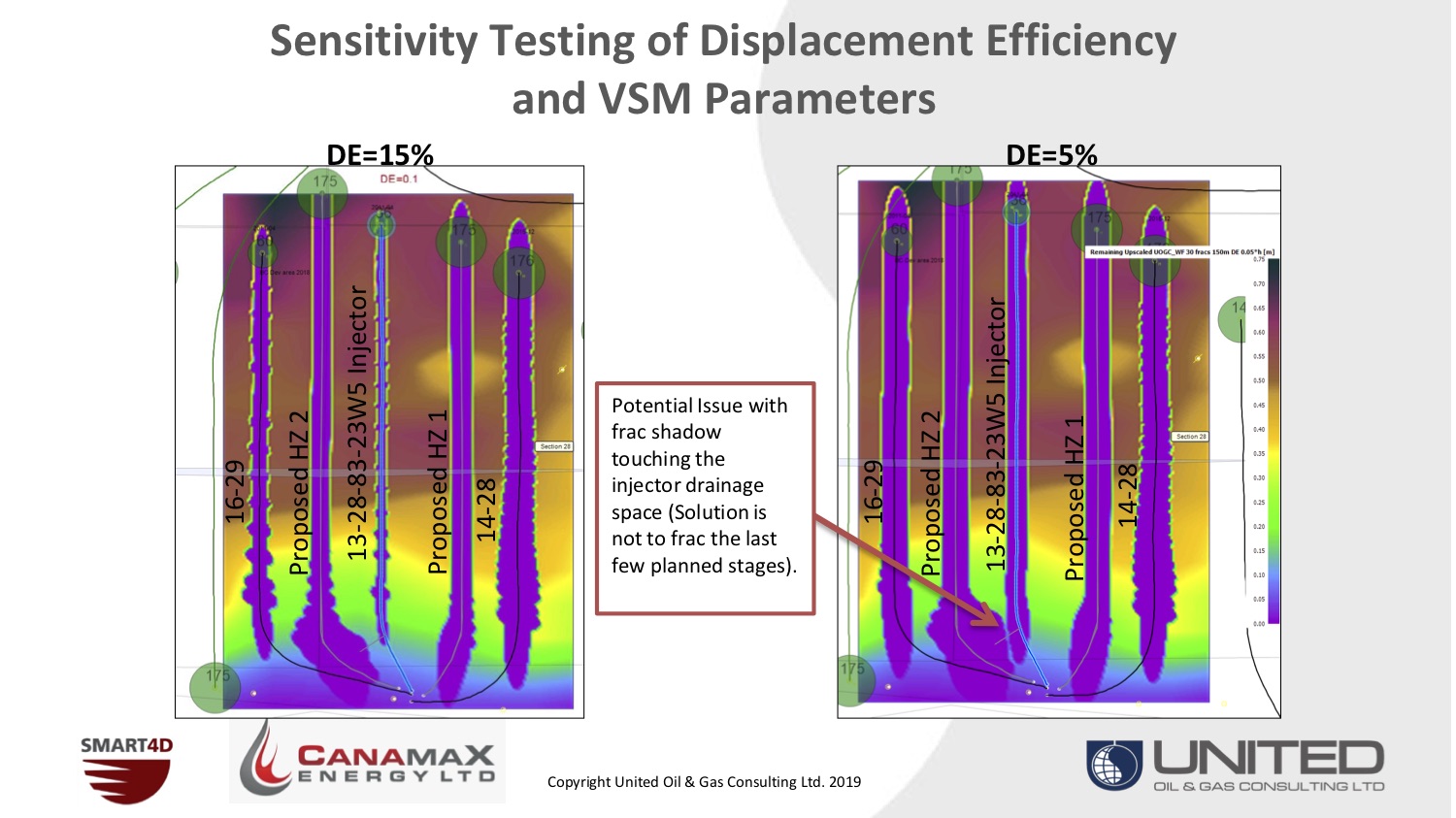
- Model fracs and their Shadows
- Identify depletion from multi-stage fracs
- Mitigate frac hits
Plan Accurate Well Placement
Accurately plan your horizontals and geosteer them in SMART4D, or with our geosteering service
- We recommend practical and cost saving pre-frac steps
- We evaluate well placement and spacing for efficient development
- We identify footprint boundaries and enable you to exploit remaining hydrocarbon opportunities in mature and more complex fields