UNITED has developed SMART4D Geosteering to be a more powerful software than the traditional 3D and 2D geosteering and geomodeling software. We have addressed the main pain points of using a geomodeling software, and improved specific areas to make our 3D software light and fast.
SMART4D uses stronger stratigraphic correlations and they can be shared with the team using any offsets at any time. With a tight interface with showing the right data and a simplified workflow that allows you to run the model frequently (every 3-10 minutes).
You are able to completely recalculate the drilling corridor on the path of the well plan on the fly, and forecast apparent dip, structure, isopachs and rock properties for a better while-drilling experience. You can initialize a 3D model quickly and model 3D rock properties map variably including its isopachs and uses all 3D data and incoming data simultaneously.
UNITED’s and SMART4D’s approach differs from most 3D products, as they are heavy, expensive and too slow for a real-time operation. When faced with a decision between traditional 3D products and real-time operations needs most opt for a simpler 2D approach. We don’t believe you have to make that sacrifice.
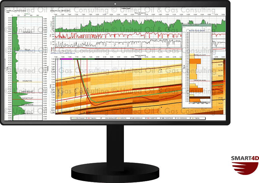
SMART4D Geosteering Software makes you better equipped to more efficiently geosteer your wells in real-time using a robust 3D geological model that is updated while drilling to mitigate well placement risk and optimize well placement.
SMART4D 3D models use automated data collected through WITSML. The software successfully combines the real time geology interpretation changes while-drilling, leveraging directional driller tools and sensors to provide an optimal well placement solution in a 3D environment.