SMART4D Software
SMART4D is geomodelling, reservoir engineering and geosteering software developed by United Oil & Gas Consulting.
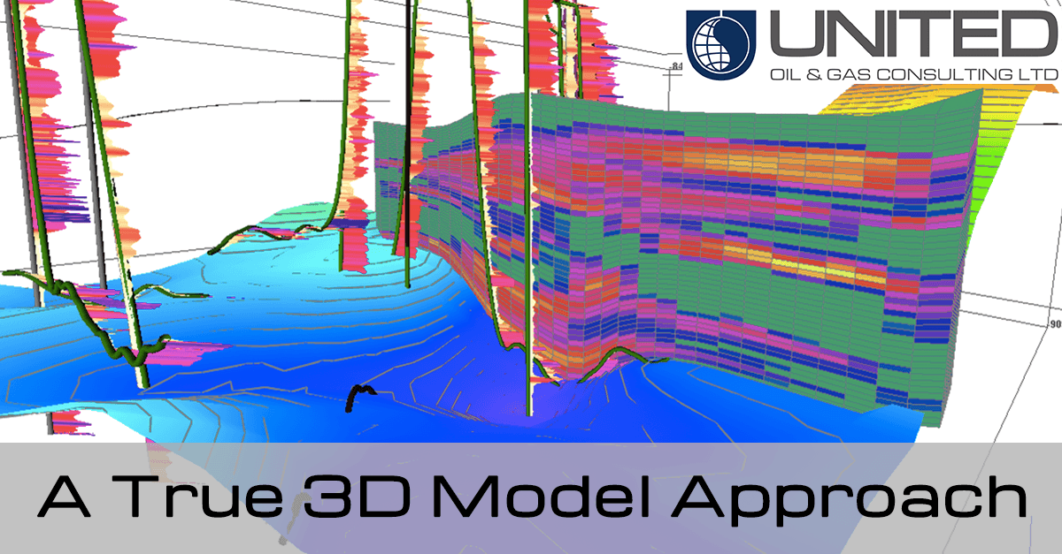
SMART4D provides a start to finish reservoir modeling and analysis tool that incorporates all available geological and geophysical data into a clean, easy to use, multifaceted display. The software also contains quality control tools for geostatistical mapping and characterization.
- Spatial geostatistical mapping
- 3D maps for reservoir characterization
- Petrophysical characterization and visualization
- Flexible horizontal panels to analyze your wells and reservoirs
The 3D models created in SMART4D can be used for geosteering or reservoir studies. The geosteering module combines the real time geology interpretation changes while-drilling, leveraging directional driller tools and sensors to provide an optimal well placement solution in a 3D environment.
SMART4D software package is composed of three modules: Geo-modelling, geosteering and reservoir engineering modules. The three modules combined allow for a complete pre-drill, while-drilling, and post-drill analysis of the reservoir.
Currently the SMART4D Geomodelling and Geosteering Application is available for licensing and purchase. Reservoir Engineering services can be combined with SMART4D licensing.