At UNITED we have been developing geosteering and geomodeling software and technology for over 20 years. UNITED and SMART4D has been involved with over a 1000 horizontal wells, geosteering and providing consulting services for oil and gas exploration. SMART4D Geosteering Software has been developed to allow operators and exploration companies to geosteer their own wells.
Our geosteering software clients teams now manage the drilling programs and operations geology for resource plays following anywhere from 1 to 15 rigs at a time. Operators are seeing from 18% to 25% reduction on rig days, added accuracy and efficiency over what they were doing previously.
SMART4D and UNITED’s Services have been applied in most major resource plays in North America, such as the Permian and the Montney. Additionally, it has been used on wells in Australia, New Zealand and Indonesia.
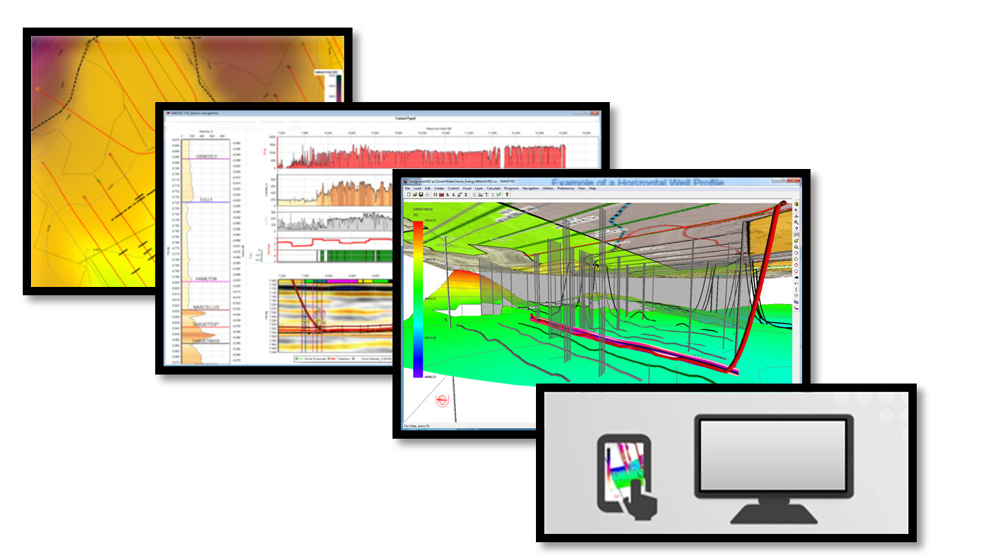
SMART4D Geosteering Software makes you better equipped to more efficiently geosteer your wells in real-time using a robust 3D geological model that is updated while drilling to mitigate well placement risk and optimize well placement.
SMART4D 3D models use automated data collected through WITSML. The software successfully combines the real time geology interpretation changes while-drilling, leveraging directional driller tools and sensors to provide an optimal well placement solution in a 3D environment.